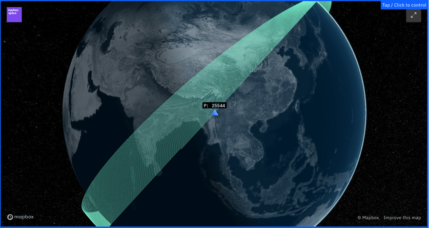
SAN FRANCISCO — Kayhan Space unveiled Satcat, a new source for information on objects and events in Earth orbit.
Satcat, short for satellite catalog, merges open-source data on spacecraft and debris with tools to simplify research and analysis.
In the past, “if you wanted to collect information about satellites it simply wasn’t easy,” Araz Feyzi, Kayhan co-founder and chief technology officer, told SpaceNews.
Satcat.com pairs information on recent and historical locations of active and decaying satellites with satellite communicates frequencies and space weather data.
“Creating Satcat was driven by a passion for simplifying access to vital satellite data for aerospace industry professionals and enthusiasts alike,” Hyun Seo, Kayhan vice president of product and Satcat lead designer, said in a statement. “Industry professionals, including our in-house astrodynamics team, often rely on multiple datasets with different interfaces, scales, and units, significantly slowing them down. By unifying these diverse datasets into a single place, Satcat streamlines the research and analysis process for these professionals and beyond.”
Data Sources
Users can search Satcat’s database of more than objects by name, object type, launch date, country of origin, apogee and perigee.
Satcat pulls in data from: Space-Track, the U.S. Space command catalog; GCAT, Jonathan McDowell’s General Catalog of Artificial Space Objects; Mike McCant’s web page; and launch activity from The Space Devs. Space weather information comes from Celestrak, GFZ-Potsdam, Kyoto University, Natural Resources Canada, NASA, the National Oceanic and Atmospheric Administration’s Space Weather Prediction Center and Solar Influences Data Analysis Center at the Royal Observatory of Belgium.
Satcat generally includes four years of historical two-line elements for space objects. Users can opt for visual representations of orbiting spacecraft, rocket bodies and debris.
Through a Discord server, Kayhan is seeking feedback from users.
“We’re hoping that folks will tell us how they’re using Satcat, what else they would like to see and how it’s helping them on a daily basis,” Feyzi said.
Satcat Sandbox
Satcat’s advanced analytics tools are available through the Satcat Sandbox.
In Sandbox, users can compare the location of a primary satellite with two-line elements for a maximum of 10 secondary objects.
“Kayhan’s tools help analysts quickly navigate contextual data to make sense of orbital events,” Maj. Sean Allen, U.S. Space Force’s Space Systems Command’s Space Domain Awareness Technology, Applications and Process Lab chief, said in a statement. “For example, how many objects have Chinese spaceplanes deployed? What else is in a similar orbit? These tools make it easy to answer these questions.”
