When a seismic signal was picked up by sensors all over the world last September, many scientists raced to investigate where it had come from.
It turned out that a landslide in Greenland, a mountainside of rock that collapsed and carried glacial ice with it, generated a 200-metre wave on September 16. That wave then remained “trapped” in the narrow fjord for nine days, moving back and forth and generating the vibrations.
Scientists have warned that landslides such as this are happening more frequently due to climate change as the glaciers that support Greenland’s mountains continue to melt.
The results of the investigation into this event, which are published in the journal Science, is the outcome of a detective mission involving an international team of scientists and the Danish Navy.
“When colleagues first spotted this signal last year, it looked nothing like an earthquake. We called it an ‘unidentified seismic object’,”Dr Stephen Hicks from UCL, one of the scientists involved, told the BBC.
He added: “It kept appearing – every 90 seconds for nine days.”
He added that colleagues in Denmark who do a lot of fieldwork in Greenland received reports of a tsunami that happened in a remote fjord at the same time, so the teams joined forces.
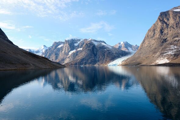
The team used the seismic data to pinpoint the location of the signal’s source – Dickson Fjord in East Greenland. They then gathered other clues including satellite imagery and photographs of the fjord that were taken by the Danish Navy just before the signal appeared.
A satellite image showed a cloud of dust in a gully of the fjord. When they compared before and after shots of the event, they revealed that a mountain had collapsed and swept part of a glacier into the water.
The researchers eventually discovered that 23 million cubic metres of rock – a volume equivalent to 25 Empire State Buildings – had smashed into the water, causing a 200-metre-high “mega tsunami”. The after photos also show a visible mark on the glacier which was left by the sediment that the giant wave threw up afterwards.
As the landslide “happened about 200 kilometres [124 miles] inland from the open ocean,” and thanks to the complexity of such fjord systems as Dickson Fjord, the wave was unable to dissipate its energy. By comparison, tsunamis (caused by underground earthquakes) that occur in the open ocean dissipate within hours.
The team created a model that showed how the wave sloshed back and forth for nine days.
“We’ve never seen such a large-scale movement of water over such a long period,” said Dr Hicks.
Scientists revealed that the landslide was caused by rising temperatures in Greenland, which have melted the glacier at the base of the mountain.
“The glacier was supporting this mountain and it got so thin that it just stopped holding it up,” said Dr Hicks. “It shows how climate change is now impacting these areas.”
While the event occurred in a remote area, the fjords are visited by some Arctic cruise ships. Fortunately, none were in the area when the landslide occurred.
However, the lead researcher, Dr Kristian Svennevig from the National Geological Surveys for Denmark and Greenland (GEUS), said this was an increasingly common phenomenon in the Arctic.
“We are witnessing a rise in giant, tsunami-causing landslides, particularly in Greenland,” he told the BBC. “While the Dickson Fjord event alone doesn’t confirm this trend, its unprecedented scale underscores the need to carry out more research.”
Dr Hicks added that the Dickson Fjord event may be the first time a climate change event has impacted “the crust beneath our feet” all over the world.
