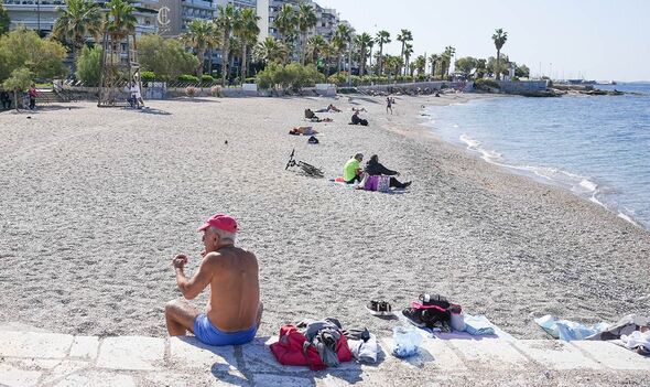
Some of Europe’s most popular holiday destinations will see record-breaking hot temperatures, but this may also come with extreme weather events, experts warn.
The warning comes as Greece endures its earlier ever heatwave, with temperatures of 43 degrees recorded in some parts this week.
Authorities in Greece have been forced to shut some tourist attractions, including the Acropolis in Athens, as well as shutting schools and nurseries.
Meteorologist Panos Giannopoulos told the Greek state television channel, ERT: “This heatwave will go down in history. In the 20th century, we never had a heatwave before June 19. We have had several in the 21st century, but none before June 15.”
Meanwhile, in Turkey, temperatures have also soared to between 8 and 12 degrees above the norm for this time of year.
READ MORE: Incredible £4.7bn plan to build new 430-mile canal connecting two seas
The country has endured wildfires as a result, causing chaos at a resort in Antalya. In Cyprus, three villages were evacuated in the Paphos District as a result of wildfires.
The hot temperatures have come as a result of southerly winds bringing heat and dust from North Africa.
But other parts of Europe have seen very different extremes. Torrential rain has led to floods in Mallorca, leaving many stranded at Palma Airport after water built up on the runway.
The Copernicus Climate Change Service’s (C3S) mid-range seasonal forecast (covering July, August and September) warns that the Mediterranean will see high temperatures while the north of Europe, including Scotland, will be wetter than usual.
Their forecast said: “The latter part of the European summer is likely to be warmer than average everywhere (with above-normal chance of exceeding the 80th percentile of climatology for seasonal means), drier than average in the south and wetter than average in the far north.”
Speaking to the Telegraph, a spokesperson for Weather & Radar said: “We can say that July 2024 is looking above-average for much of Europe, particularly Spain, however that could just be a few days of hot weather that skew the average, followed by roughly around or below-average temperatures.”
Rosie Mammatt, a PHD expert at the University of Reading, added: “We are already seeing very hot temperatures in the Mediterranean basin, and it looks like the summer could provide some more record-breaking temperatures.”
Dr Mammatt also warns that Europe could even see a “very active hurricane season.”
She continued: “It has been predicted that it is likely to be a very active hurricane season, due in part to these high sea surface temperatures. Last summer, we were in an El Niño phase, which suppressed hurricane development. This year, we are coming back into a La Niña phase which means we have more favourable hurricane formation conditions.
“Whilst the hurricanes themselves will hit countries on the over side of the Atlantic, ex-hurricanes have the capability to track back across the ocean and bring heavy rain and strong winds to Europe.
“However, this is very uncertain as it is partly reliant on the position of the jet stream, which is much harder to predict in advance.”
