The Weather Channel has a simulation of surge heights of 3 feet, 6 feet, and 9 feet. The surge could be up to 15 feet.

Weather Channel Simulation
It irritating but X embeds are often messed up. Embeds from certain people don’t work, and in this case this Weather Channel Link will not embed. But click to play.
GRAF Model
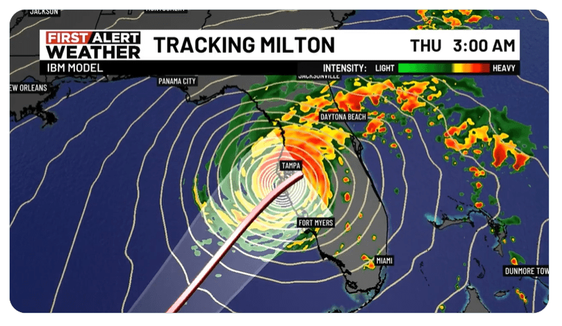
The Graph Model Link won’t embed either.
“Here’s a look at the GRAF model along with the NHC track of Milton. GRAF keeps the storm a little to the northwest but overall agrees with the NHC forecast. Tampa and areas south should prepare for a destructive major hurricane.”
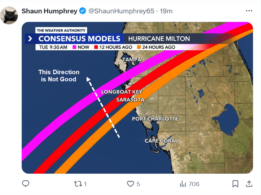
Milton Track Uncertain

The worse case scenario is for Milton to hit north of Tampa. That’s when counterclockwise movements of air will bring the most water straight into Tampa Bay.
Eye Wall Replacement
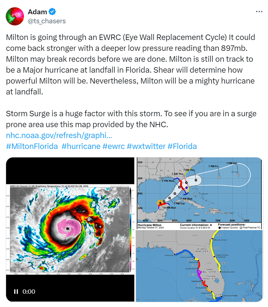
Milton formed a new wider eye. In the process it downgraded from a cat 5 hurricane to a cat 4 hurricane. Speculation now is that it may re-energize into a cat 5.
“Milton is going through an EWRC (Eye Wall Replacement Cycle) It could come back stronger with a deeper low pressure reading than 897mb. Milton may break records before we are done. Milton is still on track to be a Major hurricane at landfall in Florida. Shear will determine how powerful Milton will be. Nevertheless, Milton will be a mighty hurricane at landfall.”
Milton is the 5th most powerful storm on record based on the low pressure reading of 897mb.
Milton Reintensifying

That image is as of 9:50 AM · Oct 8, 2024.
Consensus Model
Best Wishes.
